AI’s Growing Role in Conservation and Conservation Technologies
The term “Artificial intelligence” (AI) gets thrown around a lot in the tech space. It’s one of those buzzwords everyone has heard, but few really understand. The U.S. State Dept. quotes the National Artificial Intelligence Act of 2020 saying “The term ‘artificial intelligence’ means a machine-based system that can, for a given set of human-defined objectives, make predictions, recommendations or decisions influencing real or virtual environments.” AI comes in many forms; including machine learning, machine vision, artificial general intelligence (AGI), and generative AI.
AI first appeared in the 1950s. Around this time Alan Turing created the Turing test, which would evaluate a machine’s ability to behave similar to humans. Since then AI has been integrated into numerous aspects of everyday life — it’s easy to forget that Apple’s Siri is an AI, along with Amazon’s Alexa. The term AI is often overused as a marketing tool, much like when the Internet of Things (IoT) was the latest craze and every other new device was labeled “Smart.”
Game-changing advancements in tech inevitably come with controversy. Nick Bostrom, Swedish Philosopher and founder of the Institute for Ethics and Emerging Technologies says in his book Superintelligence: Paths, Dangers, Strategies, “We’re like children playing with a bomb,” referring to AGI, a form of AI with the potential to change life as we know it. Current AI controversy mostly surrounds generative AI, which often learns from unethically sourced training material and has the potential to create unethical content or take work from creative individuals.. We are proud to say this article was written by a human, not ChatGPT.
Here at GroupGets we’re excited by the ways AI is being used in conservation, so we decided to do a deep-dive into the ways AI is assisting conservationists, as well as how it’s being integrated into conservation technologies. AI also has the potential to do great things, and we believe the use of AI machine vision to help conservation efforts is a good thing.
One way that AI is making a huge difference for conservationists is by doing the work for humans by identifying animals, reptiles, fish, and even insects. Without AI, a researcher might have hundreds of hours of footage to pour over to identify the number of individual species of fish in a lake and their population.
With the proper training datasets (a dataset being a set of example photos for training purposes), AI can be taught what to look for so that it can take the burden of identification off researchers. Just like camera traps take a picture when they notice movement, you can have AI identify an animal (for example a bear — I’lll explain later) and execute a program that scares the bear away from a particular area. This can be to keep them away from a populated area like a town or city, away from a roadway, or anything else that could cause the animal harm.

That was oddly specific, no? Well, you’re right. That was a reference to a project taking place in Romania, where bear populations have gotten a little too comfortable around humans, and have been treating farms and other such properties as grocery stores. The people do their best to remove the bears kindly and relocate them, but in the past the bears have been killed if they wouldn’t come quietly, as they say.
The camera traps were integrated with the YOLOv5 AI platform that identifies the bears. Once a bear is identified it executes a command for a repellant, in this case an audio and visual combo. A speaker emits a series of loud noises that, coupled with an array of flashing lights, help keep bears out of the city of Rucăr.
The same tactic of creating training datasets is being used in the Kakadu National Park in Australia. Researchers had over 300 hours of footage to go through to identify species and population density within billabongs in the park. In the linked video, one man talks about how they created the datasets, which was its own involved process of identifying fish, drawing boxes around them, or placing polygons over the fish for the AI to analyze.
Although there are a lot of man-hours involved in creating the datasets, after they are employed it drastically decreases the workload for researchers and conservationists, which is a major reason so many people are integrating AI into their projects. The Kakadu research team is also using AI in their drones to map vegetation in the park.

AI doesn’t just help with locating and identifying animals, it can also help find people — people like poachers. Game Rangers International, partnered with the WWF, Cisco Systems, and Teledyne FLIR to launch the Connected Conservation Initiative (CCI) which “has installed a virtual fence of networked thermal imaging cameras across the key trafficking routes of Lake Itezhi-Tezhi.”
In an article titled “ Five Ways AI is Saving Wildlife — From Counting Chimps to Locating Whales “ The Guardian elaborates on the CCI, saying that when the fence was installed in 2019, “the cameras were monitored manually by rangers, who could then respond to signs of illegal activity. FLIR AI has now been trained to automatically detect boats entering the park, increasing effectiveness and reducing the need for constant manual surveillance. Waves and flying birds can also trigger alerts, so the AI is being taught to eliminate these false readings.”
CCI is monitored in the Musa Command Post, and has strike team capability by Marine Anti-Poaching Unit and Special Anti-Poaching Unit (SAPU) South.

Mentioned in the same article by The Guardian, AI is being used to monitor water loss in Brazil. This is important, not only for Brazil but for the world, as Brazil has 12% of our planet’s freshwater reserves. Since the early 1990s, the entire region has lost 15.7% of its surface water. MapBiomes used machine learning (ML) to analyze more than 150,000 images that were taken by Nasa’s Landsat 5 satellite, as well the Landsat 7, and 8. Researchers used the data from 1985 to 2020 and focused on an area of 8.5 million sq km in Brazil. In 1991 the surface water covered 19.7 million hectares. Since then it has been reduced to 16.6 million hectares in 2020, showing a 15.7% depletion.
The researchers at MapBiomes used AI to analyze the data. The artificial intelligence was able to distinguish between natural and man-made water bodies, and was a huge help in processing over 108 terabytes of images. They have made their data accessible on this platform in annual, monthly, and accumulated maps and stats spanning 1985 to 2021. As stated on their website, their research is “open to everyone.”
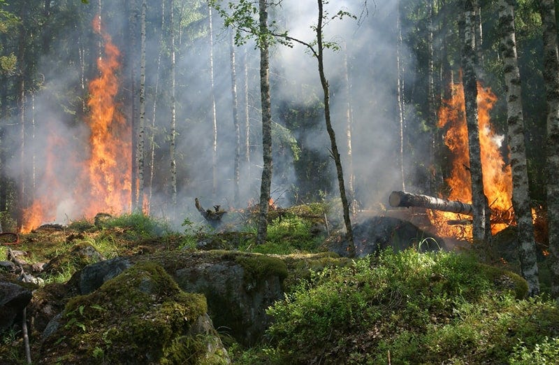
Drought and heat waves caused David Bonn to create a wildfire detection system after his home was threatened by fires in July of 2021. He and his company developed a system that uses a FLIR Lepton 3 and OpenCV image processing to identify first a hot spot, then an area of turbulent motion. Turbulent motion can be the simple act of hot air rising, but when it appears above — or overlaps — a hot spot, it can mean there are flames present.
Bonn then says in an interview with PyImageSearch “The optical algorithm then takes that candidate region and translates their coordinates to the optical camera’s coordinate system. Thus, by carefully looking at the candidate region, I can choose a good slice of the optical image suitable for passing to a well-trained binary classifier.” He then says that “If both the thermal algorithm and the classifier agree there is a fire, the system goes into an alarm state.”
Bonn first discusses how he used the Raspberry Pi for the detection system, but then he turns to the Purethermal 2 USB module because as he says “I could experiment with image processing algorithms for the thermal camera on a laptop. So rather than upload code to the Pi and reboot the Pi and look at another display to see the output, I could just have a code-test-debug cycle on my laptop and work on the software at my desk, on the kitchen table, or at a bakery. So I rapidly got a lot more time on the system and learned more in a month than I had in the previous six months.”
The system is still in the early stages, and the AI is still learning — hot exhaust from large vehicles, especially farm equipment confuses the AI, which can even be triggered by brightly colored birds that get too close to the sensors. Bonn is still working to perfect his fire detection system that could change the way we handle wildfires, and potentially save a lot of lives, both human and animal.
I talked in a previous article on conservation technology about the IUCN’s Red List of Threatened Species, which is a list of species that are threatened with extinction. If you’re wondering, and even if you aren’t, the number is 42,100 species, which is 28% of the 150,300 species that have been assessed.
Maintaining biodiversity is a bigger issue than ever, with more and more species dwindling out of existence during our lifetimes. Loss of species biodiversity can permanently alter an environment, not to mention its impact on humans through loss of food, medicine, fiber, shelter, and many more factors. Therefore, we want to highlight some amazing ways AI is being used to understand and protect biodiversity. There are a few programs such as Zonation, CAPTAIN and MARXAN. These help researchers identify areas in the most need of biodiversity protection. I’m going to focus on one, though; CAPTAIN.
CAPTAIN (Conservation Area Prioritization Through Artificial Intelligence) is an AI platform where researchers and conservationists can input biodiversity data, climate change models, the pressures of human populations, and even budget restraints. All this data goes into what they call a neural network, which is a series of algorithms that mimics the way the human brain operates.
CAPTAIN runs through scenario after scenario, merging the data provided to see if it can save as many species as possible in an area, while sticking to the funding restraints and weighing the costs and benefits for each situation. You can set your own parameters for the data, including minimizing species loss, minimizing economic value loss, and maximizing the area that is protected. CAPTAIN is an open-source AI platform that is downloadable from their site (linked above).

Some AI’s come in easy-to-use apps, like iNaturalist, which is a community driven platform that helps people take photos and identify taxa of different species they come across. Once you upload a photo, both AI and researchers work to classify the species.
Another, Conservation AI can identify species, model biodiversity, and be integrated into tech like camera traps to give real-time detection and classification. There’s also WildTrack that helps with footprint identification using data analytics, artificial intelligence, and ecological knowledge. WildTrack boasts that their “morphometric and AI models can provide accuracies of >90% in classifying by species, individual, sex and age-class. These data are made available for species protection and the mitigation of human-wildlife conflict.”
It seems like soon there will be nothing that AI can’t do. However, it’s important to remember that AI is not always perfect, I think anyone who has used ChatGPT can confirm this. There is still a lot of room for improvement, as there will be times when AI misidentifies a species, or counts an animal more than once in a series of images. Many scientists and researchers urge everyone to check over the data AI renders, just to be sure. But you know what they say, “to err is human.”
Originally published at https://groupgets.com.